BC's
Royal Tour:
From Prince George to Prince Rupert by RV |
Northern
BC's Yellowhead Highway (Highway
16) is fast becoming one of Canada's most popular routes for RV
exploration. Beginning on the Queen
Charlotte Islands, Highway 16 stretches over 1,000 km/625 miles,
linking Graham Island with the mainland port of Prince Rupert, and
extending through the Rocky Mountains to the province of Alberta.
Lush fertile valleys, towering mountainscapes and captivating lakes
fill the western section of this region, which extends from the shores
of the Pacific Ocean to the city of Prince
George.
There
are more than 10 provincial parks and numerous private RV parks with
full and partial hook-ups, sani-stations and other amenities between
Prince
Rupert and Prince George. Acting as the connector for many of
northern communities, Highway 16 provides an excellent setting for
RV'ers and campers who enjoy the remoteness of the outdoors and the
comfort of their own schedule.
If
you are travelling from Vancouver and points south, Highway 1 and
97 will take you to Prince George, the departure point for this trip.
Follow Highway
1 east to Hope,
and then north through the Fraser Canyon. When you reach Cache
Creek, you will pick up Highway
97 north.
Travelling
from the east, you can access Highway 16 at several junctions in Alberta.
The road west to Prince George will take you through Jasper and Mount
Robson Park, which are famous for their amazing landscapes.
Prince
George sits at the junction of two rivers, the Fraser and Nechako,
on what was once the traditional First Nations trading route for the
Carrier and Sekani. The city has several excellent museums, the most
famous being the Prince George Railway Museum. The Native Art Gallery
features exhibits from local Native artists.
The
local rivers offer some great opportunities for canoeing and kayaking.
The Northwest Brigade Canoe Club has published a book that can give
you more information about the river conditions, which run from flatwater
to Class V rapids.
Prince
George is also the junction for the Alaska Highway (Highway 97 north)
and the Yellowhead Highway (Highway 16). In this case, your journey
takes you west 97 km/61 miles on the Yellowhead Highway to the town
of Vanderhoof,
in the centre of the region's ranching and logging area. It is also
a haven for wildlife photographers and birdwatchers will enjoy the
Vanderhoof Bird Sanctuary, a stopping point for Canada
Geese in the spring and fall.
|
|
|
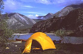
Camping
|
|
Photo
courtesy of Roger McColm
|

The
Lakes District features over 300 wilderness lakes. Stuart
Lake is 60 km/38 miles north of Vanderhoof on Highway 27 at the
town of Fort
St. James. There are two provincial campgrounds at the southeast
end of the lake (Paarens Beach Provincial Park and Sowchea Bay Recreational
Area) and both accept reservations.
Beaumont
Provincial Park sits on the shores of Fraser
Lake, 37 km/22 miles west of Vanderhoof. Some of its sites are
wheel- chair equipped.
The
town of Burns
Lake (129 km/81 miles west of Vanderhoof), is the gateway to one
of BC's largest recreational areas, Tweedsmuir
Provincial Park, and the starting point to the popular Lakes District
Circle Tour. The tour escorts you along the shores of Burns and Francois
Lakes, winding up at Houston
74 km/46 miles west of Burns Lake. The local Forest District office
can provide maps of preferred camping and fishing areas on this route.
|
|
|
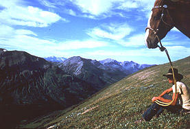
Northern
Rocky Mountain.
|
|
Photo
courtesy of WayneSawchuck
|

Like
many of the small communities in this area, the town of Houston dates
back to the early 1900's. Its first hotel was a large tent, but the
reputation of this area for steelhead, coho and spring salmon fishing
is legendary. Smithers 64 km/40 miles west of Houston, sits at the
gateway to several well-known recreational areas. The Babine Mountains
Recreational Area and Driftwood Canyon Provincial Park are approximately
15 km/9 miles east of the town (look for the turnoff in Smithers).
Visitors can stroll through fossilized lake beds (fossil collecting
is prohibited) and view the ancient remains of insects, fish and plants
that have been preserved by Mother Nature. A secondary road takes
you further to Babine
Lake and a limited number of campsites. Amenities are few but
the remote nature of the area is worth it. Be sure to check with the
Smithers Info Centre to ensure your vehicle will be up to the current
road and weather conditions.
|
|
|
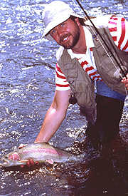
Fishing
|
|
Photo
courtesy of Mark White
|
Bulkley
Valley has been known for its Bavarian-like pastureland, with mountain
ranges that are legendary both for their beauty and extraordinary
hiking opportunities. Take the turn-off to Twin Falls and Glacier
Gulch 4 km/2.5 miles west of Smithers. Glacier-fed streams, spectacular
waterfalls and breathtaking vistas are all part of this excursion.
The three-hour hike is recommended for moderately experienced trekkers.
The
remarkable history of Northern BC's Aboriginal and pioneer villages
have been a magnet for many travellers in this area. The
Hazeltons, 68 km/43 miles west of Smithers, are three communities
linked by the pioneer history of the 1900's. The 113 km/71 mile Hands
of History tour and journey to North America's oldest totem at Kitwancool
begin here. The totems at Kispiox
and Kitwanga, also part of this tour, tell their own stories of this
area's 10,000 year-old culture.
A
visit to this area is not complete without taking the Nisga'a Circle
Tour through the ancient Nisga'a Memorial Lava Bed and the beautiful
Nass Valley. The Terrace Tourism office can provide directions to
the Nisga'a Memorial, located 100 km/60 miles north of Terrace
on Nass Valley Road. Prince Rupert (132 km/83 miles from Terrace)
is the last stop on this tour. The city was the brainchild of a railroad
tycoon who believed that he could make
Prince
Rupert the commercial centre of BC. One is left to wonder whether
his vision would have succeeded - had he not taken a fateful voyage
on the Titanic in 1912. Now the hub of fishing commerce for Northern
BC, Prince Rupert is also the departure point for tours to the Queen
Charlottes and numerous adventures north.


